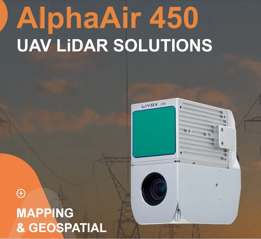
Newly Upgraded Laser Scanner CHCNAV AlphaAir 450 Integrated Multi-Sensor UAV Surveying System
- Airframe Design:
- Made of carbon fiber material, with a lightweight of only 4.5kg for easy portability and operation
- Dimensions: 1.6m length, 2.2m wingspan
- IP43 dust and water resistance rating, suitable for harsh environments
- Flight Performance:
- Maximum flight range of 50km, maximum flight time of 45 minutes
- Maximum flight altitude of 5000m
- Maximum wind resistance of 12m/s
- Takeoff/landing weight of 10kg
- Navigation System:
- Integrated high-precision GNSS+IMU navigation system
- Positioning accuracy up to 2-5cm
- Automatic flight planning and intelligent obstacle avoidance
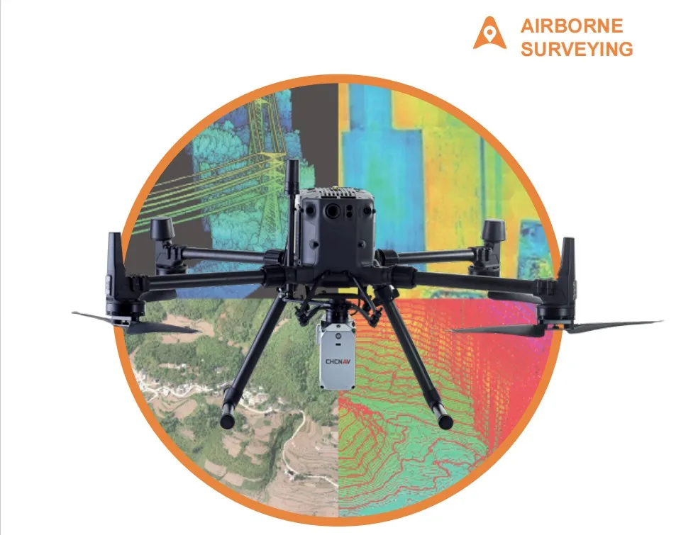
- Payload System:
- Integrates high-resolution cameras, thermal imagers, LiDAR payloads, etc.
- Maximum payload capacity of 3kg
- Customizable to meet specific customer requirements
- Remote Control System:
- 2.4GHz data link with a maximum control distance of 8km
- Ground station software provides one-click takeoff/landing and other intelligent control functions
- Supports both manual remote control and autonomous flight modes
- Safety Assurance:
- Complies with relevant safety certification standards
- Multiple safety protection measures, including battery, remote control, and other redundancies
| item | value |
| Warranty | 1 year |
| Customized support | OEM, ODM, OBM |
| Place of Origin | China |
| | Shanghai |
| Brand Name | CHCNAV |
| Model Number | AlphaAir 450 |
| Product name | CHCNAV Airborne LIDAR System AlphaAir 450 |
| GNSS system | Dual-frequency GNSS GPS, GLONASS, BeiDou, Galileo |
| Absolute accuracy | <10 cm Hz <5 cm V |
| Communications | 1*port for GNSS antenna Skyport interface 1*USB Type-C |
| Data storage | 256 GB |
| Max. returns supported | Up to 3 |
| Laser class | 1 (in accordance with IEC 60825-1:2014) |
| Camera type | Built-in calibrated Camera |
| Precision | 15 mm |
| IMU update rate | 500 Hz |
Packing & Delivery

Certifications

FAQ
1. who are we?
We are based in sichuan, China, start from 2016,sell to Africa(30.00%),Southeast Asia(16.00%),Mid East(11.00%),Eastern
Asia(10.00%),South America(10.00%),Central America(5.00%),South Asia(5.00%),Southern Europe(5.00%),North America(4.00%),Eastern
Europe(4.00%). There are total about 11-20 people in our office.
2. how can we guarantee quality?
Always a pre-production sample before mass production;
Always final Inspection before shipment;
3.what can you buy from us?
GNSS RTK,Total station,Level,Survey accessory,laser rangefinder
4. why should you buy from us not from other suppliers?
1.More than 20 years of experience in the trade field. 2.All products will have been strictly quality checked in factory before
sending out and all products have one year warranty.
5. what services can we provide?
Accepted Delivery Terms: FOB,CFR,CIF,EXW,FAS,CIP,FCA,CPT,DEQ,DDP,DDU,Express Delivery,DAF,DES;
Accepted Payment Currency:USD,EUR,JPY,CAD,AUD,HKD,GBP,CNY,CHF;
Accepted Payment Type: T/T,L/C,D/P D/A,MoneyGram,Credit Card,PayPal,Western Union,Cash,Escrow;
Language Spoken:English,Chinese,Spanish,Japanese,Portuguese,German,Arabic,French,Russian,Korean,Hindi,Italian
Product Tags:

|
|
OEM CHCNAV AlphaAir 450 UAV Drone Survey And Mapping 256GB Images
|